New hiking trip: Lista – Kvinesheia – Kvås
Hey there!
In this post I have mentioned some Norwegian locations. Maybe this is not that interresting for you guys who don't live here in Norway? So bear with me and leave a comment if you have some improvement tips. I have taken a lot of pictures and I hope you get inspired by the Norwegian nature and landscape!
Lately I've been hiking a lot and I've been testing out several new hiking spots that I'm looking forward to sharing with you ...
But before I go on about my experiences, I must say that this is a difficult time for many. Covid-19 spread so quickly and I can not quite take in how serious this is. I myself have poor immune system and am at risk. I mostly isolate myself to be on the safe side, but I already know how difficult it is to be isolated over a long period of time. I try to take just one day at a time and make the best of the situation. Fortunately, there is one thing covid-19 has failed to take away from us and that is the opportunity to go hiking. There have been some long walks lately and I'll start with this one. Enjoy!
Lista Fyr- Kvinesheia -Kvås
Day 1:
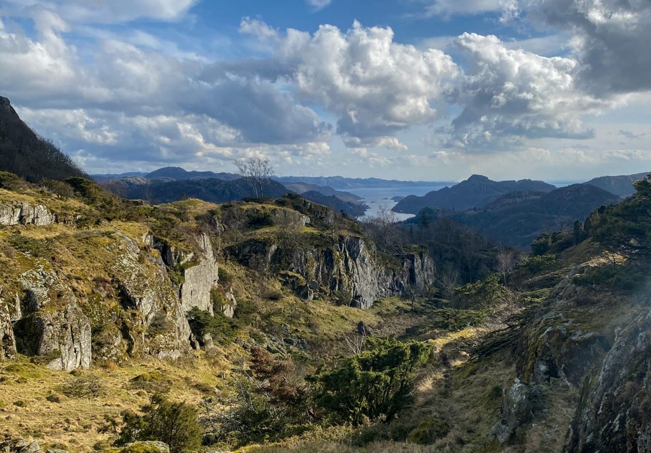
The hiking trip started at Lista Lighthouse (South Norway). We walked along the coast until we reached Stavestø. From here we went to Hervoll Mill and then to Tomstadtjønna. Here we stopped and took a long break. We also went to Elledalen, through the windmill park and to Frøystivannet where we set up the tent. That day we walked about 17 km/10,56 mi.

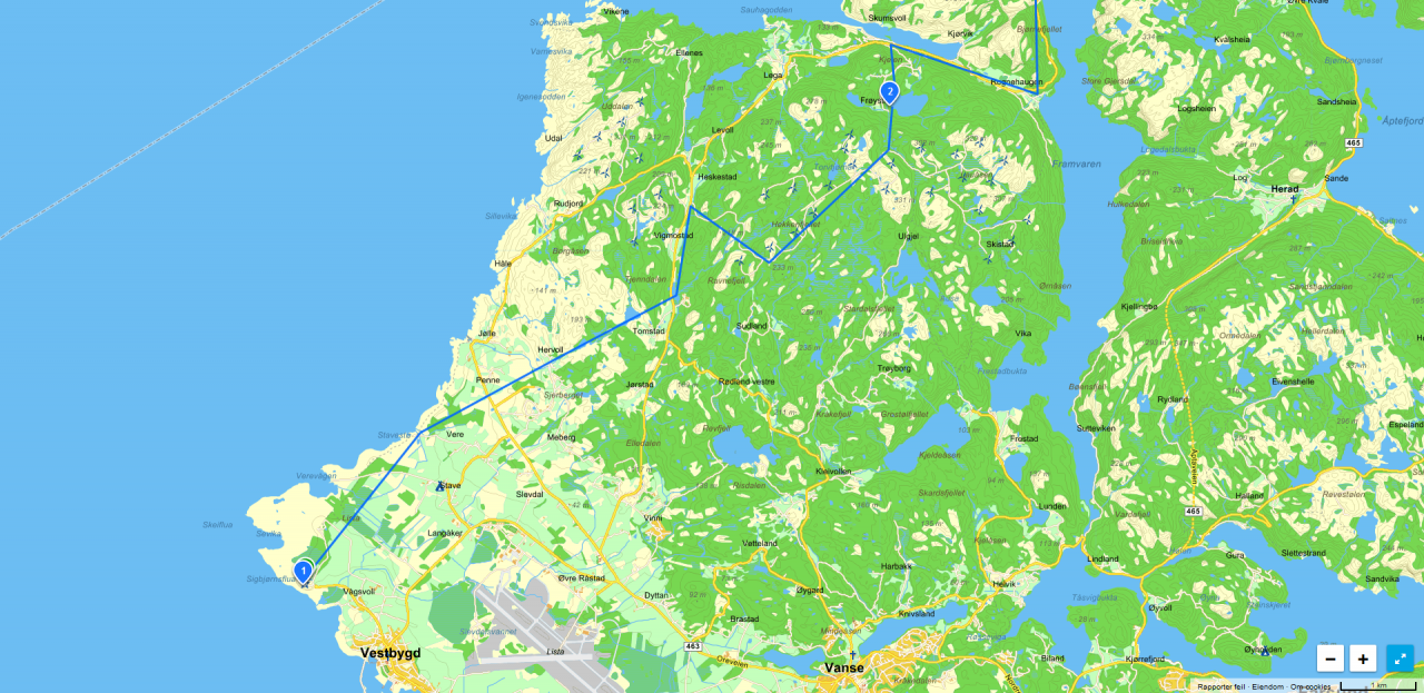
Day 1: Lista Fyr - Frøystivannet
Map: Click here
Usually I go on day trips, but this trip was going to be over several days. I was really excited about how this was going to go and whether my equipment was good enough for this type of trip.
The first day went very well! I'm not used to carry heavy backpacks and you can see it when I walk, but it got better when I got the backpack well adjusted. When we arrived at the campsite, we collected wood, lit a bonfire, cooked dinner and went fishing. My shoes were pretty wet after walking in the marsh. I placed them beside the fire so they could dry. What I didn't know was that the shoes were getting really warm. Smoke was arising fro mthe shoe and when I tried to remove the shoe it appeared that the plastic had started to melt. I got a lot of melted plastic on my finger and a lot of blisters to...
The next morning we woke up to bird chirps. AND what a beautiful view!! Simply a lovely experience. We had breakfast and fished a bit before packing up and moving on.
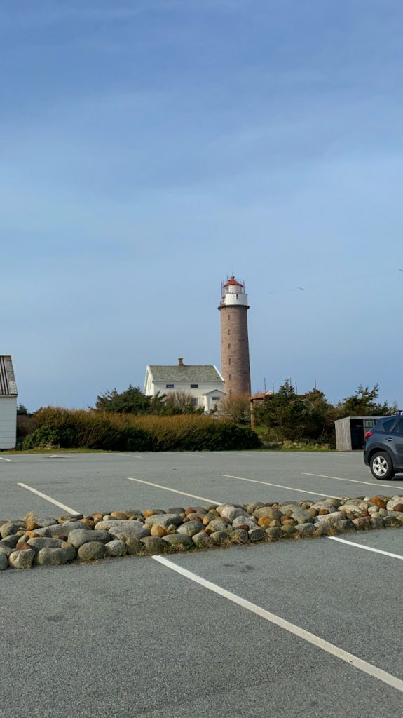
Starting place: Lista lighthouse


Hervoll Mill


Tomstadtjønna

Frøystivannet


")
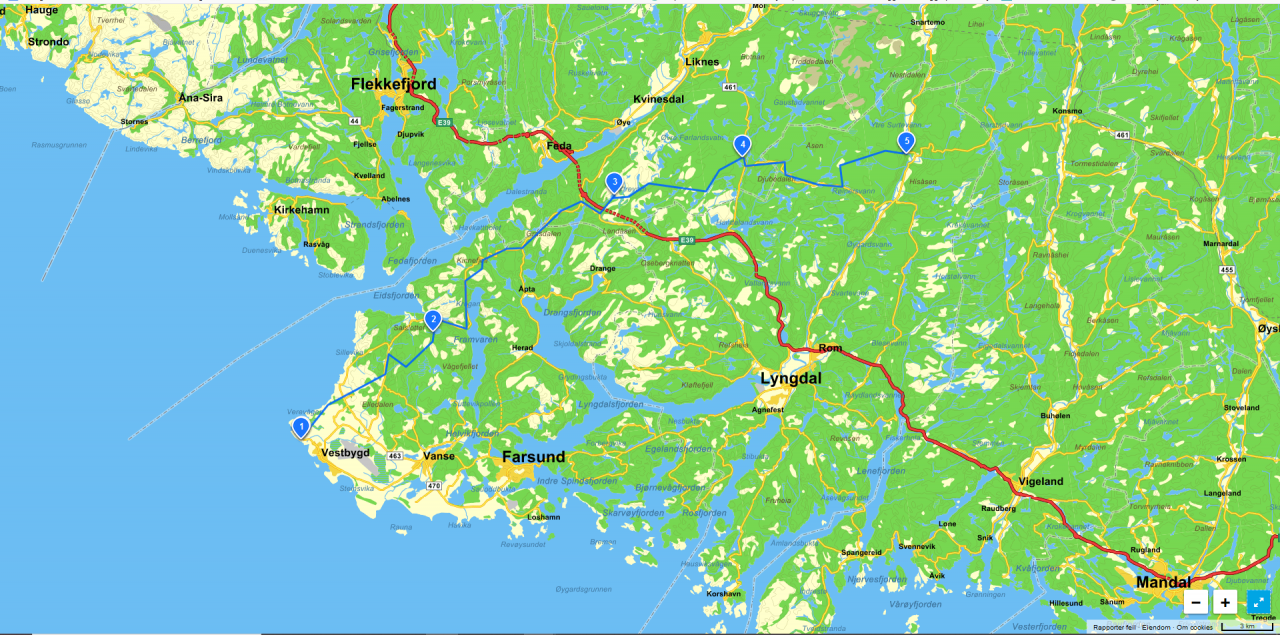
Day 2:
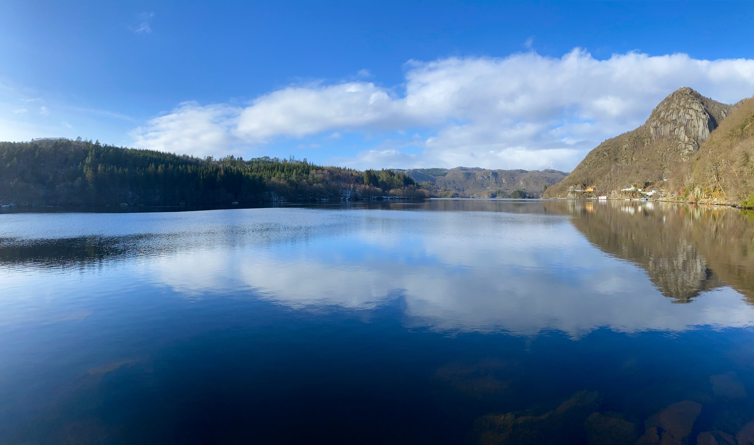
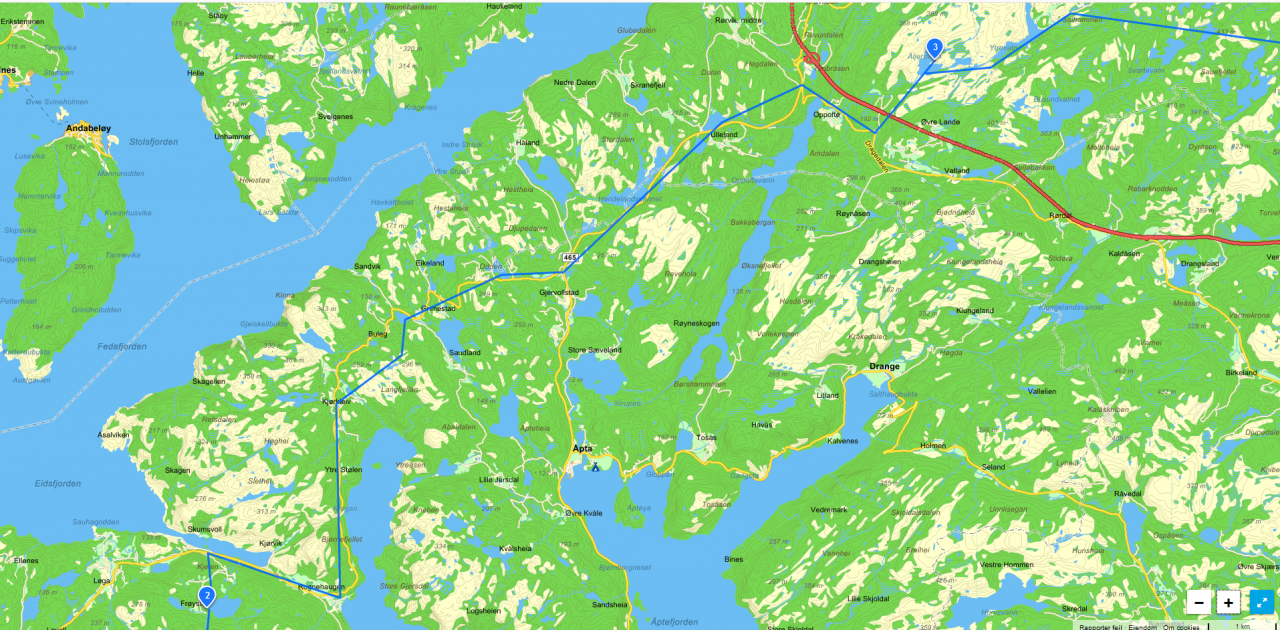
We went to Sigersvoll and on to Listeid. Then we walked along the water Framvaren until we reached Kjørkleiv. Here we walked over the terrain until we reached Sandviktjødna and Urevannet where we had a long break with some fishing, without any luck. Then we walked the main road all the way to Oppofte. Here we had a good break. At this point we both had sore feet and I was full of blisters on my heels and toes. Thank God for the blister patches! We continued on until we reached a path that led us to Ålekjervatnet. A lovely place! Here we set up the tent, collected wood, lit a bonfire, cooked dinner, relaxed and planned the next day. This day we walked about 24 km.

")
Framvaren

We have arrived Kvinesdal

Ålekjervatnet


Dag 3:
The night was freezing! When we woke up, the tent was covered in frost. I slept on a sleeping mat that was meant for summer times, so this was very cold.
As the sun came up, it became warmer in the air. I tried fishing without luck. So far we had seen some fish, but the fish didn't bite. As we were about to leave, my boyfriend showed me something he found. I don't understand how this has happened ... Did it get stuck? Has anyone hung it there?? At least it was very pretty even though it was dead...


Lizard
Unfortunately we both ran out of power here. When we tried charging the cellphones with the power bank it turned out that it was completely discharged. Now we no longer had a watch, gps or cellphone coverage. On the rest of the trip we navigated only by using a map and a compass. And the sun was our new clock.
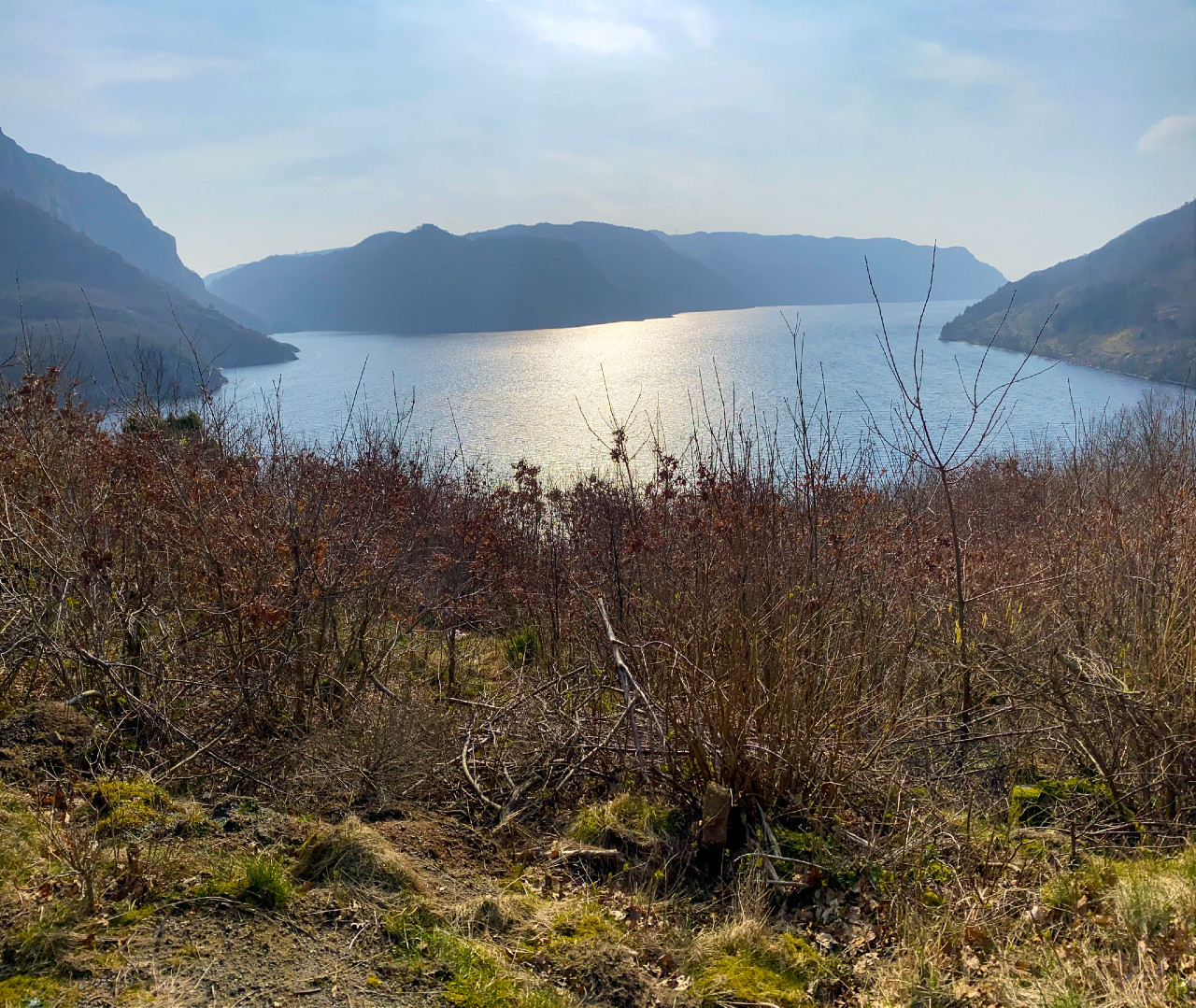
From Åljersvatnet we crossed the terrain to Staddeland. Here we walked a little on a road before crossing the terrain again and came to Sørhelle. The first house we came to was pink with green window frames ... Yes, a bit strange ... Then we went on our way past Nordhelle to Austre Førland. Here we set up the tent. We did what we usually did, collected wood, lit a bonfire, cooked dinner, relaxed and planned the next day.

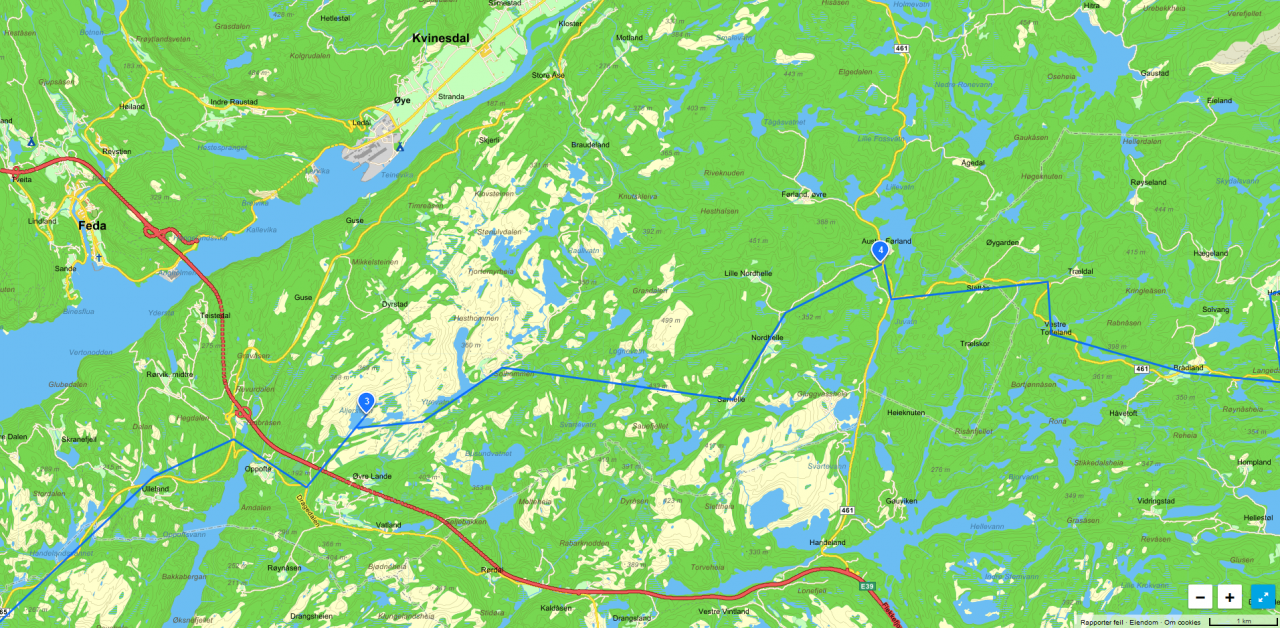
Dag 3: Åljersvatnet - Austre Førland
Kart: Klikk her
Day 4:
We followed a traffic road a short distance before we took off on a minor road. We followed the road well past Brådland until we came to a dirt road that went to Hestad. From Hestad we walked on a path to Sandvatnet. Here we took a long break and went fishing. There were no fish here either. We crossed the terrain to Dydland and here we saw a Moose. It was a great experience!
From Dydland we followed a dirt road all the way to Kvåsfossen which was our goal. It was a good feeling getting to the final destination but at the same time a little sad that the trip was over.
At this time my whole body was aching, but in a good way. In total we walked about 80 km in four days. I have already bought new hiking equipment that will be of good use next trip.

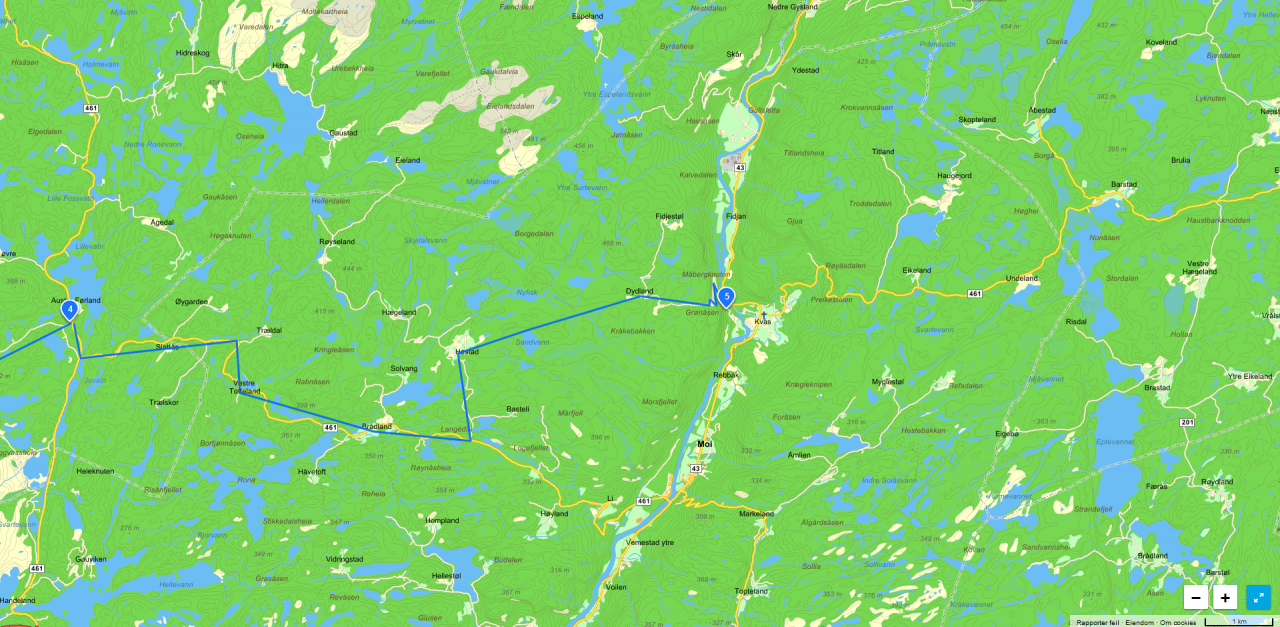
Day 4: Austre Førland - Kvåsfossen
Map: Click here
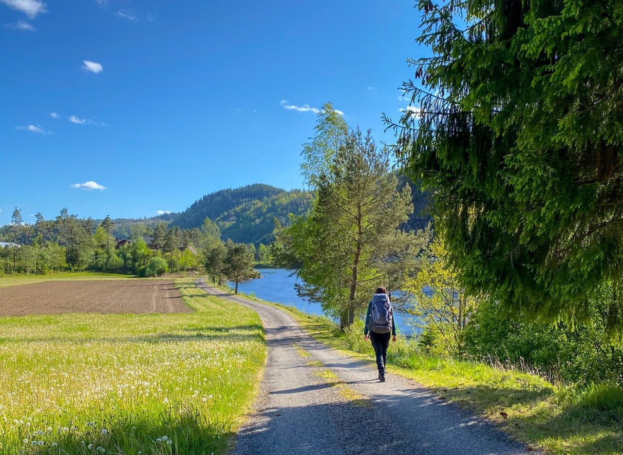
When we got home we ordered pizza, bought a lot of snacks and enjoyed ourselves. Well deserved!

I hope you enjoyed the post. Feel free to like or leave a comment.
See ya!